(Georgia State University Magazine, Fall 2012)
STORY BY JEREMY CRAIG, PHOTOGRAPHY BY STEVEN SWIGART
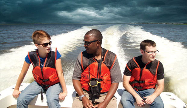
CUMBERLAND ISLAND, NATIONAL SEASHORE, Ga. — “Nature writes a book for you,” says assistant professor of geosciences Lawrence Kiage while at the wheel of a pickup truck bouncing along an unpaved, one-lane road.
“We’re here to decode what’s written.” On this hot June afternoon, Kiage and his team of researchers are digging deep into the dirt on this pristine barrier island to better understand threats from the skies: giant storms.
Over the past century and a half, Georgia hasn’t seen many hurricanes, much less a catastrophic one in the league of Hurricane Katrina in 2005. The last hurricane to make a direct hit was Hurricane David in 1979, which made landfall as a weakened Category 1 on the Saffir-Simpson Scale.
But that’s not to say a monster of a tempest couldn’t slam into coastal Georgia in the future.
If the worst kind of hurricane struck Savannah, for example — a Category 5 with sustained winds more than 157 miles an hour — much of the city could be inundated with several feet of water. But what are the odds of the worst happening? It’s hard to have faith in the numbers when probabilities are based on only 150 years or so worth of recorded storms.
Kiage wants the odds to be more precise.
His work is part of a relatively new science — “paleotempestology,” the study of ancient storms. And it might just be the key in better preparation for the worst.
Written in Sand and Sediment
When a hurricane hits a coastline, it stirs up a storm surge that washes over land. It takes sand from the beaches with it, and microscopic organisms from the ocean, depositing them on adjacent marsh. Over the years, sediment is deposited over the sand washed up by hurricanes.
“During the course of normal sedimentation, you’ll find a lot of peat there in the clay,” Kiage said. “So when we have a storm bringing in the sand, you’ll see a very immediate break in the natural deposition.”
The layers of sediment between the sand deposits can tell how active — or quiet — storms were during a given time period.
On Wassaw Island, for example, where he did preliminary research before obtaining National Oceanic and Atmospheric Administration (NOAA)/Sea Grant funding for this much larger project, he was able to infer a record of hurricanes stretching back nearly two millennia before present.
There, the record showed periods of increased activity from around 2,000 years ago to around 1,100 years before present, and then another active period from 100 years ago to now. The sand and sediment seem to point to a quiet time between 1,100 years ago to 250 years ago.
To determine the time periods, Kiage is using different types of data, including remnants of vegetation buried in the ground.
“If we can find something that represents vegetation, we can infer as to which climate was prevailing at the time,” he says.
Pollen is a good indicator of vegetation, showing which types of vegetation existed at a certain location — allowing scientists to infer climate, chemistry of water and even human activity.
The thickness of overwash layers can also tell scientists the strength of a given hurricane. Stronger hurricanes are accompanied by large storm surge and will push more sand into adjacent marsh than weaker ones.
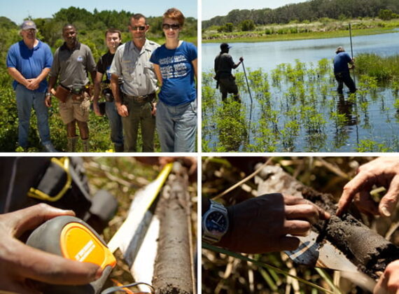
To get a better feeling for how overwash layers indicate hurricane strength, Kiage and his team had to go to oneof Georgia’s peaceful, naturally kept wonders — Cumberland Island.
In the late 1890s, before hurricanes were given names, a storm estimated by modern standards to be a major Category 4 storm made landfall on the island. If Kiage can get a good core sample, he could have a better guide in order to infer the strengths of ancient storms.
“If we can get that, it would be really, really successful,” he said.
Digging Deeper
As Kiage’s truck followed Doug Hoffman, a National Park Service wildlife biologist, to Whitney Lake on the north end of the island, some of the island’s native wildlife — deer and wild horses — brought Kiage’s trek to a halt.
“When I grew up, these were the kind of roads I went down when I was in Kenya,” he said. Similar dusty, bumpy roads in his native land wind their way through African environments that are changing — leading him down the path to studying ancient climates.
One of his first academic projects was to study Kenya’s Lake Baringo, a receding, 50-square mile lake in a semi-arid environment.
There, he studied the climates of ancient times, as well as gathered hints about human activity around the lake. Later, during his studies at Louisiana State University, he was introduced to the study of ancient hurricanes.
Here on Cumberland Island, he and his crew lugged their equipment another mile through the sands to Whitney Lake on the north end of the island, where Kiage hoped to pull some core samples.
One problem: the lake was relatively parched as Georgia has suffered from drought.
“The lake is dry, but there’s an area with water that’s possibly spring fed,” Hoffman told Kiage. “It’s the only most significant amount of freshwater on the island.”
Through the brush, Kiage; Terry McCloskey, a Louisiana State University post-doctoral fellow, undergraduate
Amber Keller and graduate student Dan McCartha made their way to the lake.
Getting the core samples wasn’t an easy task on Cumberland. McCloskey, forced his entire body weight onto the manual corer, then, with Kiage’s help, pulled it back up to obtain a cylinder-shaped core from the lake bed. The core wasn’t exactly what they needed.
“That’s mostly sand,” McCloskey said. “I don’t think we’ll find what we need at this spot.”
They moved again, going further out into the lake, attempting to see if a derelict boat left by one of the island’s few remaining permanent residents might work to bring them towards the middle of the lake. But it was rusted out and full of holes.
After meandering in the sweltering sun and trudging through the sludge, Kiage’s team pulled out what they needed.
After the Cumberland dig, Kiage’s headed up the coast to Jekyll Island, and then just north of the state line to Hilton Head Island, S.C. for more samples.
Back in the Lab
A few weeks later in Kiage’s lab in Kell Hall, Keller took scrapings of soils from a core sample that was cut in half into tiny, thimble-sized bowls, where they’ll be heated in a kiln.
Centimeter by centimeter, the soil samples were put into a kiln, where they were heated at progressively higher temperatures, starting at 221 degrees Fahrenheit and ending at 1,832 degrees.
“When we subject the sediments to different temperatures, the reaction tells us the composition,” Kiage said.
The heating helped him detect how much organic material was in the cores.

The next step brought samples downstairs to an X-ray fluorescence spectroscope, or XRF, where he will bombard the samples with high-energy gamma radiation to detect what types of elements — such as iron, titanium, chlorine and sodium — are contained in the sand.
“A sand layer brought in from the ocean has a much higher chlorine content,” Kiage explained.
To detect the types of vegetation found in the cores, which helps scientists put a timeframe on the sediment layers, the team sought to identify pollen, using powerful acid to pull it from the sediment.
“Pollen can help determine vegetation conditions,” Kiage said. “In a hurricane event, the storm will disturb the vegetation.”
All of the work took the entire summer to analyze, and the team took another trip to the coast, at St. Catherines Island, to pull up more core samples.
Storms of the Future
Kiage said that there are a number of different hypotheses that attempt to explain the frequency of hurricanes and the steering of them.
Some tie hurricane activity in the Atlantic Ocean to the El Niño climate pattern — a temporary change in the climate of the Pacific Ocean characterized by unusually warm ocean temperatures. Its opposite is called La Niña, where unusually cold ocean temperatures prevail.
Some researchers point to the position of the Bermuda-Azores High, a large persistent center of high pressure in the atmosphere that develops over part of the Atlantic Ocean.
Other scientists point to solar activity as a possible explanation.
Right now, the Georgia coast is one of the safer places to invest on the coast, especially since the frequency of hurricanes — at least during recorded history — has been low.
“But as you invest there, somebody has to insure your property,” Kiage said. “The insurance industry will want to know some of this. The data from the project will be very useful for them to take into consideration.”
And beyond property, lives must be protected.
“Emergency managers need to be aware, because once we establish the record, and as we might get into an El Niño or La Niña year, they will be much more prepared for hurricane activity,” Kiage said.
HURRICANES IN GEORGIA
Under the Saffir-Simpson Scale, any storm with winds at or over 111 miles an hour is considered a major hurricane at Categories 3, 4 and 5. While the 20th century was relatively quiet, recorded hurricane history for Georgia started in the mid-19th century, where records show that three major hurricanes struck the coast after 1850.
In the 20th century, landfalling storms were much weaker, at Category 2 or less. At Wassaw Island, where Lawrence Kiage’s studies into ancient hurricanes started in order to secure a NOAA research grant, there were five landfalling hurricanes.
Just because a tropical system doesn’t directly strike a Georgia coastline doesn’t mean that the state won’t be impacted. Tropical Storm Alberto in 1994 — a weak tropical storm — made landfall on Florida, but stalled over south Georgia as it moved north and dumped torrential rains, leading to heavy flooding and more than 30 deaths.
Originally posted at the Georgia State website on September 5, 2012.
Retrieved from the Internet Archive Wayback Machine at https://web.archive.org/web/20121006163137/http://magazine.gsu.edu/2012/09/staying-ahead-of-the-storm/. Archived to this site on July 2, 2022.
Help maintain a record of the digital past. Donate to the Internet Archive here.